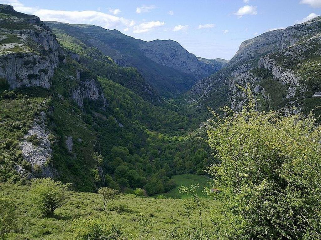
A unique area of great interest the Collados del Asón Natural Park is located in an area that has traditionally been scarcely populated and is characterized by its limestone outcrops, small beech forests and unique Cantabrian oak groves along with man-made meadows for livestock use.
The small neighborhood of Asón (in the municipality of Soba) is the only population center that is within the limits of the park.
Find a hotel in the area of the Collados del Asón Natural Park
I’ve been living in this lovely area of Western Andalucia for the last 20 years or so and dedicate most of my time to the running of English language tourist information websites for the towns of Cádiz, Ronda, Grazalema, the famous or infamous Caminito del Rey, and also Wildside Holidays, which promotes sustainable and eco-friendly businesses running wildlife and walking holidays in Spain. My articles contain affiliate links that will help you reserve a hotel, bus, train or activity in the area. You don’t pay more, but by using them you do support this website. Thankyou!
Towns and Villages: Medio Cudeyo, Liérganes, Penágos and Villaescusa
Declared a Natural Park: 1989
Park surface area: 2,588 hectares
Points of interest
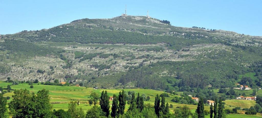
Although the Macizo de Peña Cabarga Natural Park has been a protected area since 1989 it unfortunately lost this protection in 2005 due to the lack of plans and regulations needed. Various administrations have blamed each other and as of the writing of this article the area lays in a type of limbo waiting for clarification of its status.
I’ve been living in this lovely area of Western Andalucia for the last 20 years or so and dedicate most of my time to the running of English language tourist information websites for the towns of Cádiz, Ronda, Grazalema, the famous or infamous Caminito del Rey, and also Wildside Holidays, which promotes sustainable and eco-friendly businesses running wildlife and walking holidays in Spain. My articles contain affiliate links that will help you reserve a hotel, bus, train or activity in the area. You don’t pay more, but by using them you do support this website. Thankyou!
Declared a Natural Park: 1986. (Upgraded to Parque Natural de las Dunas de Liencres y Costa Quebrada in 2021.)
Point of Geological Interest and SCI (Site of Community Interest) in 2006
Park surface area: 195 hectares initially and now 1,700 (2021)
Points of interest
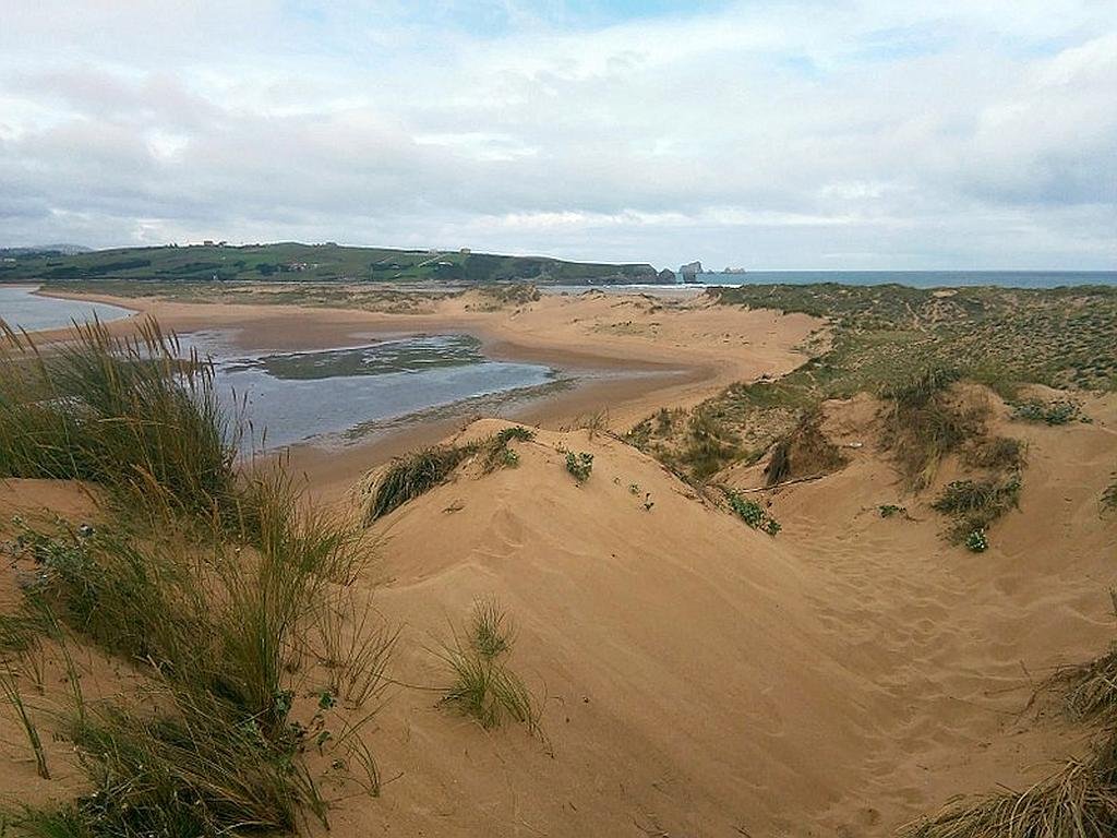
The Dunas de Liencres Natural Park is located at the mouth of the Pas river (Ría de Mogro) close to the town of of Liencres in the central area of the Cantabrian coast. The area is made up of coves, two beaches, a large maritime pine plantation and one of the most important dune systems in Cantabria.
The two main beaches are Valdearenas (golden, fine sand and dunes) and Canallave, which is oriented to the Northwest and is very popular with surfers. Behind the beaches are the dunes, greatly influenced in their shape and form by the prevailing winds.
The pine forest of Liencres
Planting of this forest commenced in the 1950s and continued into the 70’s with mostly maritime pine (Pinus pinaster) and to a lesser extent stone pine (Pinus pinea) and Monterrey pine (Pinus radiata). This, of course, has had a fixing effect on the once movebale dunes and in turn has created a recently new habitat for local wildlife.
Beaches and dunes
The beaches and dunes have scarce vegetation cover due to the special characteristics of the substrate (composed of loose sand, poor in nutrients and with a high salt content) and the climate (with strong winds). The vegetation presents special morphological and physiological features to adapt to a salty environment that does not retain water. These features are reduced and fleshy leaves and a greater development of the root system. Some of the species present are sea chard (Beta vulgaris), spurge (Euphorbia peplis), European searocket (Cakile maritime), prickly saltwort (Salsola kali) and knotgrass (Poligonum maritimum).
The estuary area at the mouth of the river Pas is a haven for both sedentary birdlife and passage migrants.
Also in the area
Piélagos is one of the most attractive areas of Cantabria for archaeological research and since the end of the 19th century, numerous sites have been discovered in the different towns.
The Altamira cave is 270 metres (890 feet) long, discovered by a hunter in 1868 it is famous for its magnificent prehistoric paintings and engravings. It can be found around 30 kilometres (19 miles) west of Santander.
Address: Museo Nacional y Centro de Investigación de Altamira Marcelino Sanz de Sautuola, S/N 39330 Santillana del Mar
The Cueva de Santián in Arce is of great interest and has Paleolithic paintings in the form of clubs or hands vertical and parallel. It was discovered by Alcalde del Río in 1905. Also in Arce there are other prehistoric caves such as Cobalejos and El Mato as well as a medieval necropolis around the church of San Julián in the village of Velo.
Find a hotel close to the Dunas de Liencres Natural Park
This natural park does not have a dedicated information centre but you can find out more in any of the local municipal tourist information offices such as the one in the town of Piélagos. If you are staying close to the city of Santander then the main tourist office there will be able to give you more information.
There are also various information boards along the routes through the forest and dunes detailing wildlife in the area.
Take a trip on the Wildside! Discover the wildlife and nature of Spain, its Natural and National Parks and find the top wildlife, activity and walking holiday companies.
Iberia Nature Forum
Struggling with identifying those bugs and beasties? Why not check out the Iberia nature Forum! https://iberianatureforum.com/
I’ve been living in this lovely area of Western Andalucia for the last 20 years or so and dedicate most of my time to the running of English language tourist information websites for the towns of Cádiz, Ronda, Grazalema, the famous or infamous Caminito del Rey, and also Wildside Holidays, which promotes sustainable and eco-friendly businesses running wildlife and walking holidays in Spain. My articles contain affiliate links that will help you reserve a hotel, bus, train or activity in the area. You don’t pay more, but by using them you do support this website. Thankyou!
Local towns and villages: Bárcena Mayor, Arenas de Iguña, Cabuérniga, Cieza, Hermandad de Campoo de Suso, Ruente and Los Tojos
Declared a Natural Park: 1988
Park surface area: 23,932 hectares.
Points of interest
The Saja-Besaya Natural Park is located in an area between the hydrographic basins of the Saja and Besaya rivers extending from Monte Río los Vados in the extreme north to the Fuentes-Palombera and Sierra del Cordel (Campoo) mountains in the south. The largest protected area in Cantabria, the entire park is also integrated into the Saja National Hunting Reserve .
The only urban area located within the natural park boundaries is Bárcena Mayor, an ancient town and a superb example of mountain architecture.
I’ve been living in this lovely area of Western Andalucia for the last 20 years or so and dedicate most of my time to the running of English language tourist information websites for the towns of Cádiz, Ronda, Grazalema, the famous or infamous Caminito del Rey, and also Wildside Holidays, which promotes sustainable and eco-friendly businesses running wildlife and walking holidays in Spain. My articles contain affiliate links that will help you reserve a hotel, bus, train or activity in the area. You don’t pay more, but by using them you do support this website. Thankyou!
Take a trip on the Wildside! Discover the wildlife and nature of Spain, its Natural and National Parks and find the top wildlife, activity and walking holiday companies in Spain.