Huétor

Situated just north east of Granada on a main arterial route park area of Huetor is limestone mountain terrain
  • Region: Andalucia
  • Province: Granada
  • Declared a Natural Park: 1989
  • Park surface area: 12,428 hectares
  • Villages and Towns in the area: Cogollos Vega, Beas de Granada, Huétor Santillán, Víznar, Alfacar, Nívar, Diezma.

Points of interest

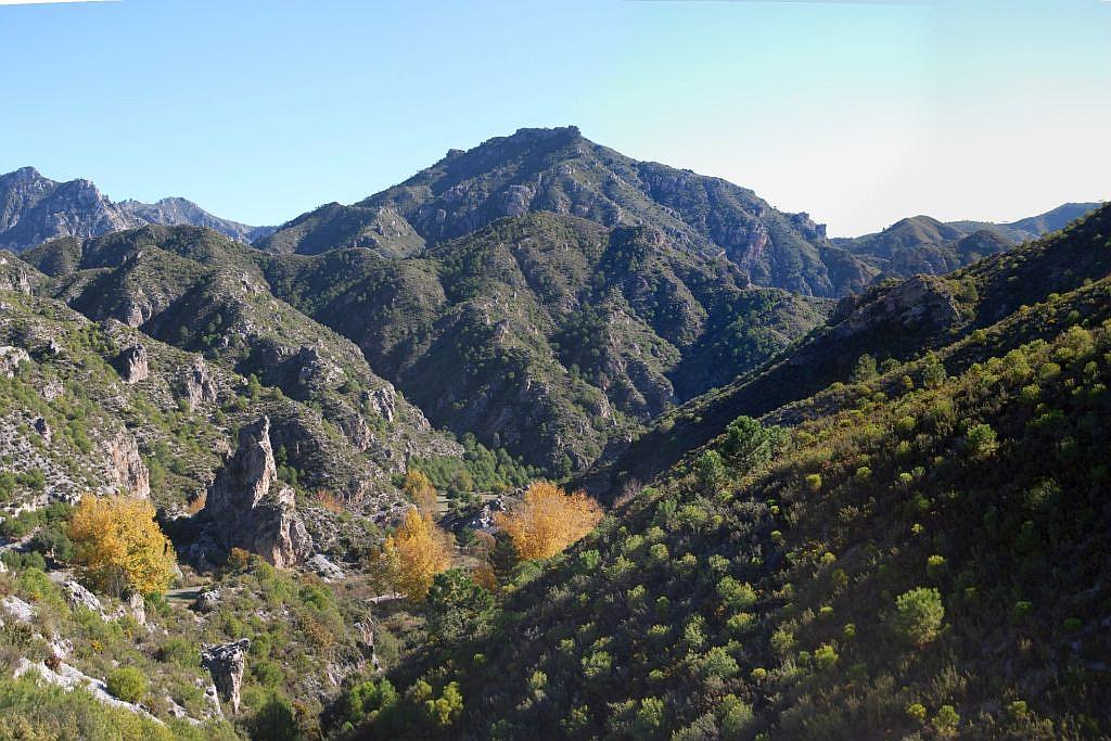
Situated just north east of Granada on a main arterial route the natural park area of Huétor is limestone mountain terrain with typical features such as steep sided ravines, mixed woodland and Mediterranean scrub. Altitude in the park is between 1,000 and 1,600meters above sea level so this area offers fantastic views across to Sierra Nevada from the viewpoint Mirador Buena Vista.

Read more

Sierra de Baza

The depression known as la Hoya de Baza and the Sierra de Las Estancias
  • Region: Andalucia
  • Province: Granada
  • Declared a Natural Park: 1989
  • Park surface area: 53,649 hectares

Towns and villages in the area

Baza, Caniles, Dólar, Gor, Valle de Zalabí

Find a place to stay in the Sierra de Baza over at Booking.com.

Points of interest

The sierra de Baza with its limestone peaks over 2000m is a relatively humid, botanical jewel between two arid plains of Las Hoyas de Guadix-Baza and the Llanos del Marquesado. It is part of the Cordillera Penibética range with the highest peak of Santa Bárbara at 2,271m. The steep slopes have a covering of pines with oaks and acer.

Read more

Sierras de Tejeda Almijara y Alhama

The peaks of the Sierras de Tejeda, Almijara y Alhama Mountains
  • Region: Andalucia
  • Provinces: Granada / Málaga
  • Declared a Natural Park: 1999
  • Park surface area: 40,663 hectares
  • Z.E.P.A

Points of interest

The parkland of Sierras de Tejeda Almijara y Alhama is limited in the south east by the Mediterranean sea and rises in craggy mountains towards the north west. 52% of the park is in Granada province with 48% in Málaga province. The combination of altitudes and from sea shore to the peak of La Maroma at 2,080m encourages a diversity of vegetation, including some endemic species.

Read more

Cabo de Gata-Níjar

Arrecife de las Sirenas in the Parque Natural de Cabo de Gata
  • Region: Andalucia.
  • Province: Almeria.
  • Declared a Natural Park: 1987.
  • Park surface area: 49.000 (34,000 terrestrial and 15,000 marine).
  • In 1997 it was designated as a UNESCO Biosphere Reserve.
  • In 2015 it was declared a global geosite.

Points of interest

Cabo de Gata-Níjar, located on the Iberian Peninsula, is an arid landscape shaped by volcanic rock, creating a challenging environment for both plants and wildlife. Its beaches are dotted with domed rock formations, while steep cliffs carve out secluded coves. The poor, nutrient-deficient soil supports mainly low-growing, drought-resistant vegetation.

This harsh environment historically limited the number of residents, who primarily survived through salt harvesting or fishing. As a result, the region remained largely untouched by development until the tourism boom of the 1980s and 1990s. The 300 hectares of salt pans are used by numerous species of birds resting on their migrational route as well the breeding and resident species.

Read more