Tag Archives: Navarra

Señorío de Bértiz Natural Park

  • Region: Navarra
  • Declared a Natural Park: 1984
  • Park surface area: 2,040 hectares
  • Towns and villages: Oieregi, Oronoz, Goitikoetxea, Aranea and Markesenea

Points of interest

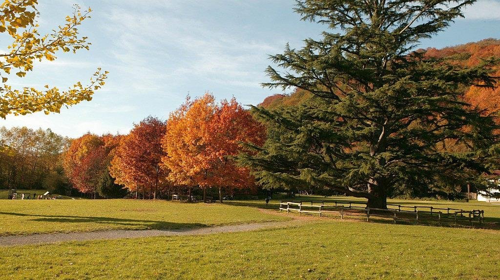
The Señorío de Bértiz Natural Park is located in the municipality of Bertizarana 49 kilometres north of Pamplona along the banks of the river Bidasoa. (Access is via the village of Oronoz in the Baztan valley or Oiergi in the Bertizarana valley).

The protected area was once privately owned and belonged to the sitting Lord of Bertiz from the 1600’s until 1898, when it was acquired by Pedro Ciga Mayo who oversaw the planting and reforesting schemes that can be seen today. He donated it to the local community of Navarre in 1949, with the condition that it was “maintained in its current condition and used exclusively for recreational, educational and scientific purposes”.

To the south, in the lower zone of the Bidassoa river and close to the town of Oronoz-Mugaire, are the palace and gardens standing on 3.4 hectares which include an abundant botanical collection, with species represented from all over the world.

The northern area of the Señorío de Bértiz Natural Park is a succession of valleys and mountains covered with native atlantic forest of beech and oak.

There are several forest tracks and footpaths that lead to the top of Mount Aizkolegi where there is a castle house, now abandoned, from which you can enjoy magnificent views of the park.

Fauna

The tranquility that this Natural Park enjoys allows the observation of some of the common mammals in the area such as wild boar, fox, badger, stone marten, hedgehog, roe deer. Others also present although with less density are otter, polecat, genet and wild cat. The Pyrenean desman, also present, is a small insectivorous mammal endemic to the Pyrenees that requires fresh and clean waters to live.

Raptors seen over the park are Golden eagle, Griffon vultures, Egyptian vultures, Short-toed eagle, Bonelli´s eagle, Booted eagle (Hieraaetus pennatus), Hen harrier (Circus cyaneus), Goshawk and Peregrine Falcon. In the evenings owls such as Eagle and Tawny can be heard but reraely seen.

Some of the birds to look out for are Alpine Accentor (Prunella collaris), Capercaillie (Tetrao urogallus, found in the beech woods), Ptarmigan (Lagopus mutus), Black woodpecker (Dryocopus martius), Middle Spotted woodpecker (Dendrocopos medius), Red backed shrike (Lanius collurio), Alpine Chough (Pyrrhocorax graculus), Red billed chough (Pyrrhocorax pyrrhocorax), Ring Ouzel (Turdus torquatus), Snow Finch (Montifringilla nivalis), Citril Finch (Serinus citronella), Cirl Bunting (Emberiza cirlus), Rock Bunting (Emberiza cia), Rock Thrush (Monticola saxatilis) and the very elusive Wallcreeper (Tichodroma muraria).

Amphibians and reptiles include Natterjack toad (Bufo calamita), Midwife toad, (Alytes obstetricans), Tree frog (Hyla arborea), Painted frog (Discoglossus pictus), Golden-striped Salamander (Chioglossa lusitanica), Alpine newts (Triturus alpestris), Iberian rock lizard (Lacerta montícola), Schreiber’s green lizard (Lacerta schreiberi), Green lizard (Lacerta viridis), and Bocage’s wall lizard (Podarcis bocagei).

Find a hotel close to the Señorío de Bértiz Natural Park

Booking.com

Walking routes in the Señorío de Bértiz Natural Park

There are some excellent walking trails here of varying distance and all are well signposted and color coded.

AIZKOLEGI (green path)
The summit of Aizkolegi (830 m.) is the highest point and has a magnificent viewpoint over Bertiz and the surrounding valleys. The last owners built a summer palace here of which the ruins are preserved.
Length: Almost 11km. along forest track.
Total route: 22km.
Average time: 6 to 7 hours

IRRETARAZU (blue path)
The Irretarazu path starts from the main path of the park at the height of Carbonera. Along the route you can see remains of some of the traditional uses of the forest: charcoal, grazing, small buildings to store chestnuts, water catchments … The path ends at the Aizkolegi track.
Length: 7km. along paths and tracks.
Total distance: 11 km.
Average time: 3.5 to 4 hours.

SUSPIRO (red path)
This path is a variant of the Irretarazu path but slightly shorter.
Length: 5 km. along paths and tracks.
Total route: 9 km.
Average time: 2.5 to 3 hours.

ITURBURUA (black trail)
This trail is a variant of Suspiro but shorter.
Length: 3 km. along paths and tracks.
Total route: 6 km.
Average time: 2 hours.

AIZKOLEGI-PLAZAZELAI (yellow path)
This path is known by the name of “straw path” as it was built to allow the passage of the straw carts bound for neighboring farmhouses.
Length: 2.5km. along the steep forest track and path.
Average time: less than 1 hour.

PLAZAZELAI (purple path)
The Plazazelai gate (540m.) Marks the limit of Señorío de Bertiz with the Baztan valley.
Length: 8km. along the forest track.
Total route: 16km.
Average time: 5 hours
This is the only route authorized for cyclists.

ERREPARATZEA(orange path)
This small walkway runs along the banks of the Bidasoa river between the main access of the park and the bridge and the Reparacea palace. This road was the main access to Bertiz until the Oronoz-Mugairi road was built.
Length: 700 m. down the old road.
Total route: 1.5 km.
Average time: Half an hour.

Information/Visitors Centers

Oficina de turismo de Bertiz (Barrio Señorío de Bertiz, s/n)

The Rural Tourism Center located in the Barrio Señorío de Bertiz has information on tourist routes, gastronomy, hospitality, culture, popular festivals.

Centro de Interpretación de la naturaleza (Barrio Señorío de Bertiz, s/n)

The wildlife interpretation centre is located in the Tenientetxea farmhouse and is filled with interpretation panels covering all aspects of the natural history, fauna, flora and geology of the area plus information on walking routes etc.

Jardín Botánico de Bertiz (Barrio Señorío de Bertiz, s/n)

The Señorío de Bértiz botanical garden is home to about 120 species from all over the world since thanks to its mild microclimate it supports plants from temperate and subtropical climates, highlighting among others, Camellias, Palms , Cypress, Araucaria, Ginkgo, Liquidambar, different species of bamboo and water lilies around a small lake.

In the 18th century Palace, temporary exhibitions are housed on its ground floor.

  • Closed Monday (Also closed for lunch from 2:00 p.m. to 4:00 p.m every day)
  • Tuesday to Friday from 10:30 a.m. to 2:00 p.m. and from 3:00 p.m. to 6:30 p.m.
  • Weekends and bank holidays from 10:30 a.m. to 7:30 p.m.

Entrance 3 Euros for adults and 1.50 for children and over 65’s

The official website for the Señorío de Bértiz Natural Park is here: http://www.parquedebertiz.es/informacion-es/el-parque-natural.html


Iberia Nature Forum

Struggling with identifying those bugs and beasties? Why not check out the Iberia nature Forum!

Discover the Iberia Nature Forum – Environment, geography, nature, landscape, climate, culture, history, rural tourism and travel.

The Urbasa-Andía Natural Park

  • Region: Navarra
  • Declared a Natural Park: 1997
  • Park surface area: 21,408 hectares
  • Towns and villages: Ziordia, Olazti, Altsasu, Urdiain, Iturmendi, Bakaiku, Etxarri-Aranatz, Ergoiena, Arakil Islands, Irañeta and Arakil

Points of interest

The Urbasa-Andía Natural Park is covered by beech forest accompanied by other species such as yews, junipers and pines. There is a great diversity of fauna and flora inhabiting this area that includes 16 rugged peaks of over 1000 metres.

In the lowlands the forest gives way to pastures dotted with heather and buckthorn where it is common to see horses and sheep grazing (think of the delicious Idiazabal cheese).

Another characteristic of this area is the absence of rivers as the limestone terrain allows the water to seep and run underground through numerous cave systems, making it a good destination for lovers of caving.

Human habitation has been traced to 100,000 years ago and there are also many dolmens, menhirs and cromlech in the area that are reminders of the Iberian celtic tribes.

There are several signposted trails of different levels of difficulty the most popular being the Itinerario de las fuentes, Ruta de los pastores, Camino de los montañeros and the Dulantz y cañon del Iranzu.

The protected area of the The Urbasa-Andía Natural Park is divided into various zones.

Sierra de Urbasa

The Urbasa mountain range is a plateau located in the northwest of Navarra that presents an average altitude of about 1000 metres. It is a great elevated plane, which descends steeply towards the Araquil corridor to the north and towards the Amescoas to the south. Together with the Andía, Perdón, Alaiz, Izco and Leyre mountains they form a geomorphological and climatic border between the Atlantic and Alpine Navarra Mediterranean area. The name Urbasa means in Basque “humid forest” (from ur “water” and basa “forest”)

Sierra de Andía

The Sierra de Andía (Andimendi in Basque) is a plateau with gentle undulations bounded by the valleys of Araquil and Ergoyena to the north and the Estella depression to the south, Sierra de Urbasa to the west and with the Pamplona basin to the east

Find a hotel close to the The Urbasa-Andía Natural Park

Booking.com

Reserva Natural del Nacedero del Río Urederra

The Urederra River originates in the municipality of Baquedano and travels 19 kilometers before flowing into the Ega river which is a tributary of the Ebro river. Urederra means “beautiful water” in Basque.

The official access path to the Nacedero del Río Urederra waterfalls is the Nacedero del Urederra Natural Reserve route, a pedestrian path that starts from the car park in Baquedano. (Take the the NA-718 Estella – Olazagutía highway and then the NA-7187 at km 13.8.

Reservation of tickets to the Nacedero del Urederra are required to visit this area. The opening hours for the Reception Area in winter are from 10 a.m. to 4 p.m and in summer from 9 a.m. to 7 p.m. The reservation to the Nacedero is compulsory and free but you do have to pay for the car parking. The rates are as follows: € 2 motorcycles € 5 cars € 10 motorhomes € 25 minibus (up to 20 seats) € 50 bus (more than 20 seats). Parking in the town of Baquedano is prohibited, you can only park in the town if you are a resident.

There is a limit of 500 people per day divided into 3 time slots. This is a circular walk, takes about 2 hours and covers 6 kilometers.

Information/Visitors Centers

Centro de Interpretación Urbasa-Andía Parque Natural

The parks information center located near the top of the Olazagutia mountain pass. KM 31,5 on the NA-718. There are exhibitions and plenty of information regarding the landscape, ecological, historical and cultural values that exist in Urbasa and Andia.

Área de Interpretación (Borda de Severino) at KM 25,5 on the NA-718

This is a small area for the interpretation of pastoral life in which a charcoal burner has been reproduced recalling the traditional uses of the Sierra de Urbasa. Its well worth a visit.

The official web page for the is https://www.parquedeurbasa.es/


Iberia Nature Forum

Struggling with identifying those bugs and beasties? Why not check out the Iberia nature Forum!

Discover the Iberia Nature Forum – Environment, geography, nature, landscape, climate, culture, history, rural tourism and travel.

Bardenas Reales Natural Park and Biosphere Reserve

  • Region: Navarra
  • Declared a Natural Park:1999
  • Declared a Biosphere reserve: 2000 (includes the Natural Reserve ‘Rincón del Bú’ and the Reserva Natural ‘Caídas de la Negra
  • Park surface area: 41,845 hectares
  • Towns and villages: Valtierra, Arguedas, Carcastillo, Santacara, Mélida, Rada, Caparroso, Villafranca, Cadreita, Tudela, Cabanillas, Fustiñana and Buñuel

Points of interest

The Bardenas Reales Natural Park and Biosphere Reserve is a semi-desert region, or badlands in the southeast Navarra. The soils are made up of clay, chalk and sandstone and have been eroded by water and wind creating surprising shapes, canyons, plateaus, tabular structures and isolated hills, called cabezos. Vegetation is scarce in many places and the small streams that cross the area are dry for most of the year.

The climate is characterized by extremes, with very cold winters giving way with almost no transition into spring and torrid summers. Rainfall, scant and irregular is frequently torrential. The action of strong dry winds, particularly from the north-east (cierzos), accentuates the aridity of the area.

Three different habitat areas are present:
  • The great plateau, known as El Plano in the north is an almost flat, elevated alluvial plateau, whose soil originates from the Aragón river.
  • La Blanca in the central area is a great depression where softer sedimentary rocks leaving clay unprotected, gives rise to spectacular erosive formations (badlands).
  • La Negra is an area located to the south is formed by plateaus of different altitudes and cut by rivers flowing at the bottom of the cliffs. (This part of the Bardenas has a lot more flora present.)

Since 1951, the Spanish Air Force has had a 2,222-hectare firing range in the Bardenas. In 2016 , the Parliament of Navarre called for the removal of the shooting range but practising still takes place throuout the year.

Find a hotel close to the Bardenas Reales Natural Park and Biosphere Reserve

Booking.com

Flora

This area is surprisingly rich in flora in terms of abundance and biogeographical significance. Common species are thyme (Thymus vulgaris ), Spanish broom (Genista scorpius) and Cistus (Cistus albidus).

Look out for Helianthemum origanifolium subsp. rotundifolium, Fumana ericoides, Fumana thymifolia, Atractylis humilis, Stipa parviflora, Centaurea linifolia and Polygala rupestris.

Brachypodium retusum grassland appears in open clearings along with interesting species such as Narcissus dubius, Narcissus triandrus subsp. pallidulus and Sideritis spinulosa.

The only forests area that exist in Bardenas are the pine groves located on the slopes of La Negra. They are open forests dominated by Aleppo pine (Pinus halepensis ) and are accompanied by species such as black juniper, kermes oak and mastic tree

Bardenas Reales Natural Park - Biosphere Reserve
Bardenas Reales Natural Park – Biosphere Reserve

Fauna

In terms of fauna, an abundance of birds of prey, such as Griffon Vulture, Egyptian Vulture, Golden Eagle and Peregrine falcon are present in good numbers along with a diversity of grassland birds, such as Great Bustard, Little Bustard, Eurasian Stone Curlew, Black-bellied Sandgrouse and Dupont Lark.

Mammals present are rabbit, hare, fox, weasel, badger, wild cat, roe deer and wild boar.

Look out for the The European pond turtle (Emys orbicularis) in ponds and lagoons.

Video of the Bardenas Reales Natural Park and Biosphere Reserve

I really like the music that goes with this video. 🙂


Information/Visitors Centers

Centro de Información Bardenas Reales Natural Park and Biosphere Reserve

Access is from the NA-8712 km. 0.8 (Tudela-Arguedas / Arguedas-Tudela)

Open from 9.00am-1.00pm and then later also from 4.00pm. (It is closed during lunchtime).

Most people visiting this area start at the visitor centre that can supply you with maps and more information about the area. Apart from biking and hiking routes many people take the signposted 34km dirt track that is passable with a normal car (You don’t need a 4×4 so long as you don’t stray off the path! 🙂 ). Be prepared for your car and you to get very dusty as you pass through areas where Star Wars, James Bond and Game of Thrones, amongst others have been filmed. Its best to arrive fairly early in order to avoid the heat of the day as there is little if any shade here.

There are many places to pull in and a wealth of photographic opportunities throughout the drive.

Also, remember that here is nowhere selling food or drink nearby so you will need to bring your own if you plan on staying a while.

IMPORTANT: Access is limited to the areas of La ralla, Rallón, La Gorra and la Balsa de Zapata during February, March, April, May, June, July and August in order to protect nesting birds and other wildlife. Just check with the tourist office if you are intending on exploring these areas.

Zona Turística El Ferial

Next to the El Ferial Reservoir. (Entrance from the N-121, km. 60,800 (Tudela-Caparroso; Caparroso-Tudela).

Here you will find a recreation area with an information point and a restaurant. there is also a bird watching observatory on the shore of the lake and some interesting footpaths.

See the official websiite for the Bardenas Reales Natural Park and Biosphere Reserve here: https://bardenasreales.es/


Iberia Nature Forum

Struggling with identifying those bugs and beasties? Why not check out the Iberia nature Forum!

Discover the Iberia Nature Forum – Environment, geography, nature, landscape, climate, culture, history, rural tourism and travel.