Category Archives: Regional Parks in Murcia

Sierra de la Pila Regional Park

  • Region: Murcia
  • Declared a Regional Park: 1992
  • Park surface area: 8,836 hectares
  • Towns and villages: Molina de Segura, Abarán y Blanca, Fortuna, Jumilla, La Garapacha, Fuente Blance, Hoya Hermosa, Peña de Zafra, and Las Casicas

Points of interest

The relatively small Sierra de la Pila Regional Park is located in the northeastern region of Murcia. Its steep reliefs are part of the limestone, dolomite and gypsum mountain ranges made up of medium-altitude massif. The park is divided into two halves separated by the Barranco del Mulo: The western part where the Caramucel summit is located at 1023 meters of altitude and the eastern part with peaks such as La Pila (1264 meters) and Los Cenajos (1200 meters ).

Continue reading Sierra de la Pila Regional Park

Calnegre y Cabo Cope Regional Park

  • Region: Murcia (Alto Guadalentín)
  • Declared a Regional Park: 1992. “Calnegre” and “Cabo Cope” Places of Community Importance (SCI) 2000. Special Protection Area for Birds (ZEPA), 2001
  • Park surface area: 10,032 hectares
  • Towns and villages: Lorca, Águilas, Calabardina and Puntas de Calnegre

Points of interest

The Calnegre y Cabo Cope Regional Park (Parque Regional Calnegre y Cabo Cope) is located in the south of the Murcia Region close to the border with Andalucia. The Lomo de Bas constitutes the northern barrier of the park and the eastern flank has a coastline length of around 17 km.

The marine environment where the area surrounding the rock of Cabo Cope is also protected as the “Submerged coastal strip of the Region of Murcia” and this landscape combines Mediterranean mountains with beaches, cliffs, salt marsh area and dunes.

Continue reading Calnegre y Cabo Cope Regional Park

Calblanque Monte de las Cenizas and Peña del Águila Regional Park

  • Region: Murcia (Campo de Cartagena)
  • Declared a Regional Park: 1992
  • Park surface area: 2453 hectares
  • Towns and villages: Cartagena and La Unión
Points of interest

The Calblanque Monte de las Cenizas and Peña del Águila Regional Park (Parque Regional Calblanque, Monte de las Cenizas y Peña del Águila) is located near the Mar Menor and Cabo de Palos and almost the entire area belongs to the municipality of Cartagena.

The protected area presents a great ecological and environmental diversity with systems of dunes, sandy areas, salt marshes, salt ponds, coves. The Humedal de las Salinas de Rasall is located in the southern part of the lagoon.

Continue reading Calblanque Monte de las Cenizas and Peña del Águila Regional Park

Carrascoy y El Valle Regional Park

  • Region: Murcia
  • Declared a Natural Park: 1979. Regional Park 1992. Also listed as a Special Protection Area for Birds (ZEPA) and a Site of Community Importance (SCI).
  • Park surface area: 17,410 hectares
  • Towns and villages: Murcia, Fuente Álamo de Murcia, Alhama de Murcia, Sangonera la Verde, El Palmar, La Alberca, Beniaján, Corvera, Gea,Truyols and Sucina.

Points of interest

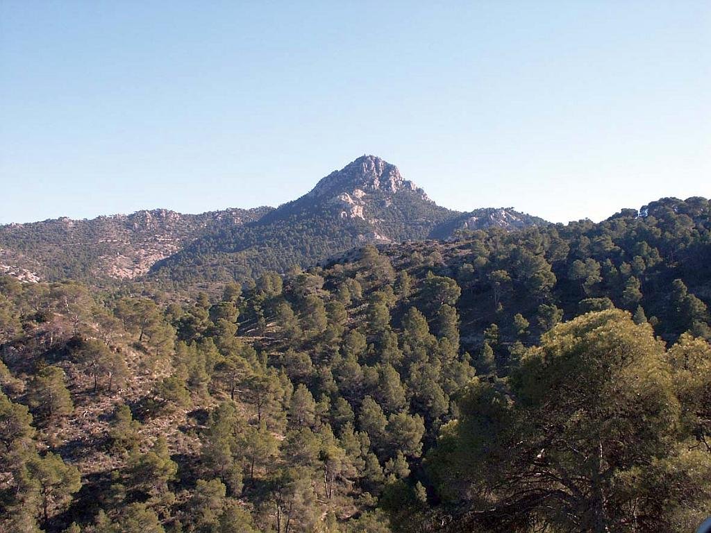
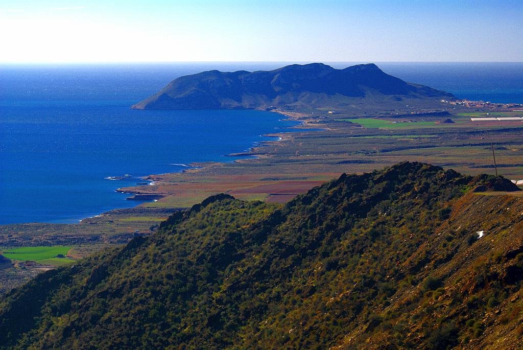
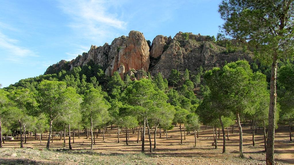
Due to its proximity to Murcia, the Carrascoy y El Valle Regional Park (Parque Regional Carrascoy y El Valle) constitutes the main “green lung” of the capital and its entire metropolitan area and It is made up of the extensive chain of mountains that close the valley of the Segura river and a part of the Guadalentín valley to the south.

Continue reading Carrascoy y El Valle Regional Park