Global geoparks in Spain protect areas with significant geological heritage while promoting sustainable tourism and education. These geoparks showcase unique rock formations, fossils, and landscapes, offering visitors opportunities to explore and learn about Earth’s history. By visiting a geopark, tourists support local communities, conservation efforts, and scientific research, all while experiencing Spain’s stunning natural beauty.
What is a global geopark? (from the Unesco website)
UNESCO Global Geoparks are single, unified geographical areas where sites and landscapes of international geological significance are managed with a holistic concept of protection, education and sustainable development.
I’ve been living in this lovely area of Western Andalucia for the last 20 years or so and dedicate most of my time to the running of English language tourist information websites for the towns of Cádiz, Ronda, Grazalema, the famous or infamous Caminito del Rey, and also Wildside Holidays, which promotes sustainable and eco-friendly businesses running wildlife and walking holidays in Spain. My articles contain affiliate links that will help you reserve a hotel, bus, train or activity in the area. You don’t pay more, but by using them you do support this website. Thankyou!
Discover wildlife watching in Spain and embark on an extraordinary adventure, where the wonders of wildlife await you. Delve into the heart of nature as you witness the splendor of our most cherished creatures in their natural habitats: the majestic brown bear, the regal Spanish imperial eagle, the awe-inspiring lammergeier, the elusive Iberian lynx, and the enigmatic Iberian wolf. Immerse yourself in magical experiences set amidst accessible landscapes and uncover the secrets of many successful conservation programs, dedicated to preserving these precious species.
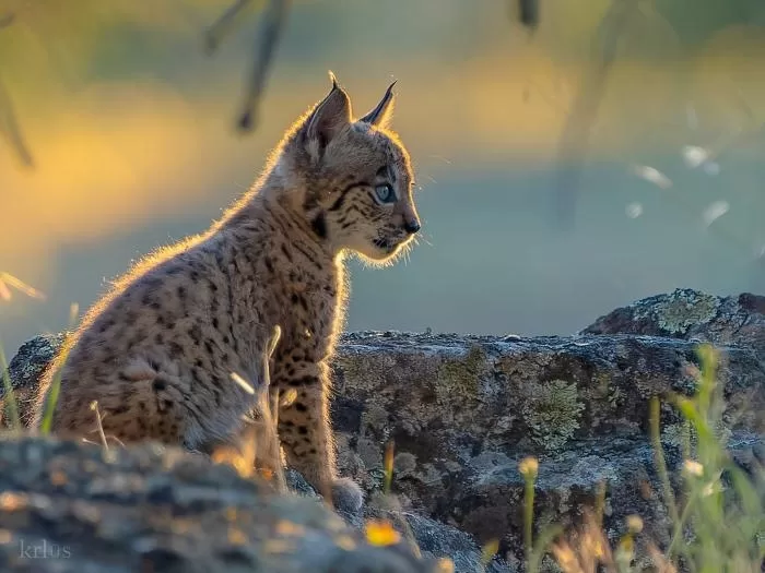
Iberian lynx
Wildlife watching in Spain
In Spain, birdwatching becomes a thrilling pursuit, with the country’s strategic location between Africa and Europe attracting millions of migratory birds and boasting numerous globally unique species. Prepare to be captivated by the wealth of biodiversity that spans across the nation. With over 1,500 protected areas—comprising a quarter of the country—Spain offers unparalleled opportunities for exploration. Dive into the depths surrounded by fields of posidonia oceanica seagrass, sail alongside playful dolphins and majestic whales, and gaze upon the stars from breathtaking vantage points. The options are as diverse as they are enchanting.
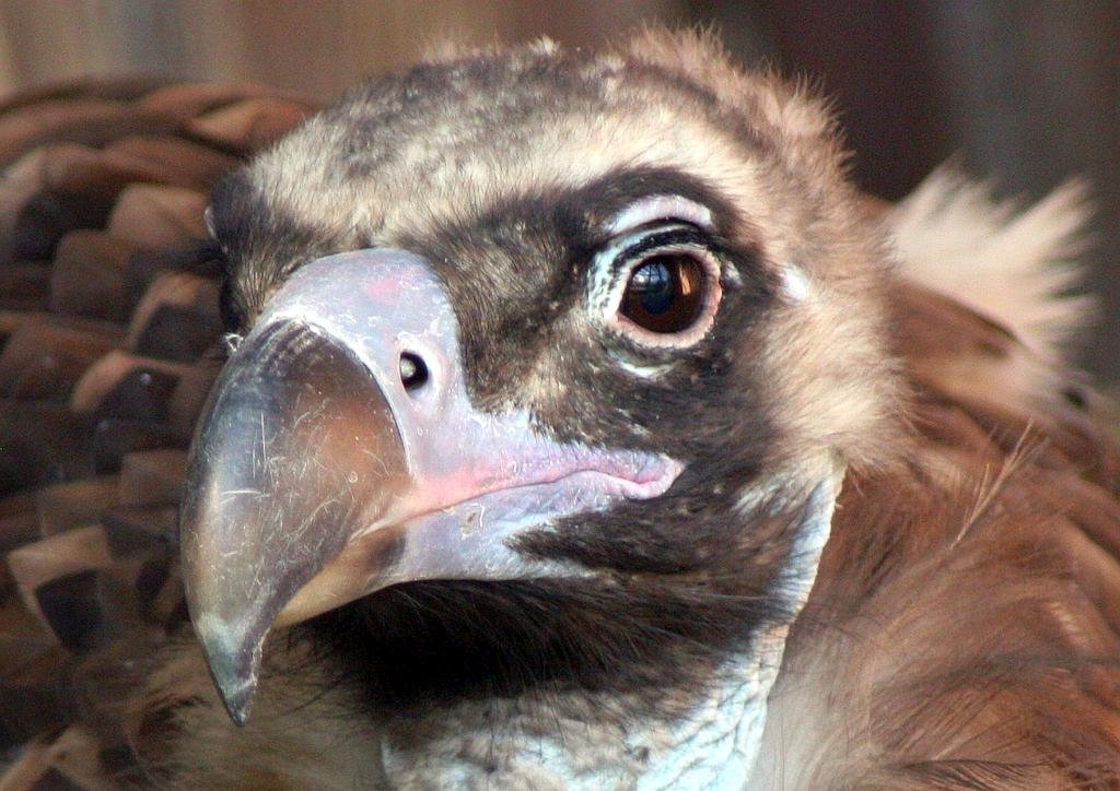
Black Vulture – aegypius monachus
Journey through Spain’s national and natural parks and embark on an unforgettable odyssey. From the dramatic alpine landscapes to the lush Mediterranean forests, each park offers a unique experience tailored to every adventurer. Discover the beauty and magic of lakes, valleys, and mountains beyond your wildest dreams. Recognized by UNESCO for its abundance of biosphere reserves and geoparks, Spain stands as a beacon of environmental preservation and sustainable development. Within its borders you’ll find numerous Protected Natural Areas that adhere to the principles of the European Charter for Sustainable Tourism (ECST), ensuring a harmonious coexistence with nature.
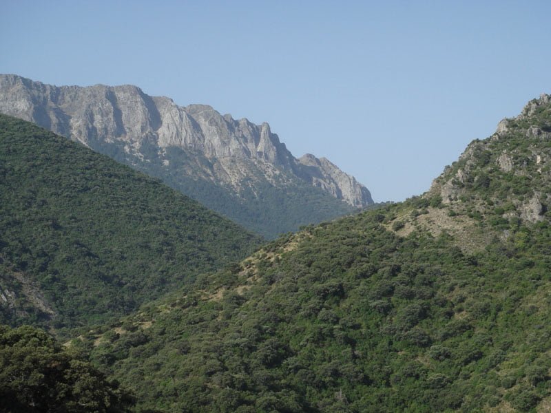
The Natural Park of the Sierra de Grazalema has also been declared a Biosphere Reserve, this is due to the diverse geography with high limestone mountains and deep gorges such as Garganta Verde
I’ve been living in this lovely area of Western Andalucia for the last 20 years or so and dedicate most of my time to the running of English language tourist information websites for the towns of Cádiz, Ronda, Grazalema, the famous or infamous Caminito del Rey, and also Wildside Holidays, which promotes sustainable and eco-friendly businesses running wildlife and walking holidays in Spain. My articles contain affiliate links that will help you reserve a hotel, bus, train or activity in the area. You don’t pay more, but by using them you do support this website. Thankyou!
Region. Aragón (Zaragoza and Teruel) Declared a global geopark: 2012 and renewed in 2020 Protected area: 270,000 hectares Towns and villages: Zaragoza and Teruel – Aguaviva, Alcorisa, Aliaga, Allepuz, Berge, Bordon, Camarillas, Cantavieja, Cañada de Benatanduz, Cañada de Verich, Cañada Vellida, Cañizar del Olivar, Castel de Cabra, Castellote, Crivillen, La Cuba, Cuevas de Almuden, Ejulve, … Read more
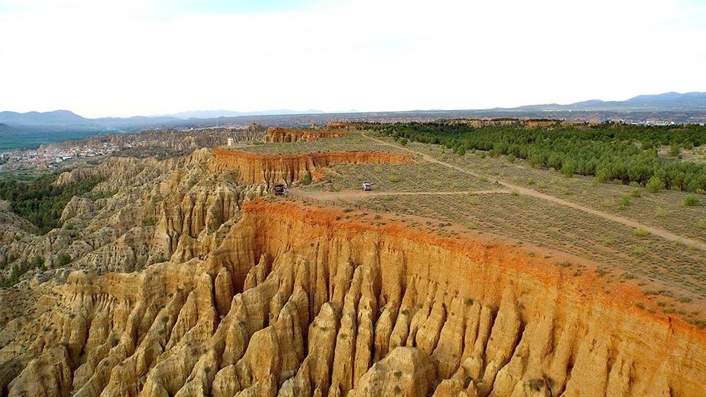
Region: Andalucia (Granada) Declared a global geopark: 2020 protected area: 472, 200 hectares Towns and villages: 47 municipalities of Guadix, Baza and Huéscar. (Alamedilla, Albuñán, Aldeire, Alicún de Ortega, Alquife, Bácor-Olivar, Beas de Guadix, Benalúa, Benamaurel, Caniles, Castilléjar, Castril, Cogollos de Guadix, Cortes de Baza, Cortes y Graena, Cuevas del Campo, Cúllar, Darro, Dehesas de … Read more