El Chorro Gorge and the Caminito del Rey

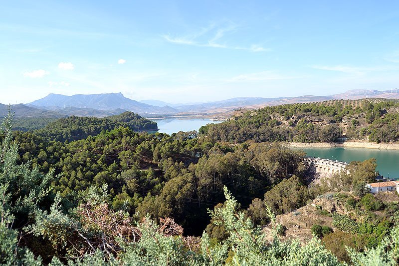
Although, strictly speaking, the Natural Reserve only included the Gaitanejo River Dam, we would be unable to understand the dynamics and complexity of the open area without the river dams that surround it which are the Conde de Guadalhorce, Guadalteba, Guadalhorce y Tajo de La Encantada), that make up, as a whole, one of the most important hydraulic complexes in Andalucia.

El Chorro Gorge and the Caminito del Rey, an impressive gorge formed by river erosion through the limestone mountain. In Spanish it is called El Desfiladero de los Gaitanes and is a well known natural attraction as the towering cliffs are around 200m high while only 10m wide at some points. The river below has been dammed, the Embalse Gaitanejo is one of the smaller reservoirs of five in this area. Alongside this reservoir sits the small village of El Chorro, built in the shadow of the mountain around the railway station.

Read more

Doñana National and Natural Parks

The Doñana National and Natural Parks occupy the northern area of the Guadalquivir river where it meets the Atlantic Ocean
  • Region: Andalucia
  • Provinces: Sevilla, Huelva, Cadiz
  • Declared a Natural Park: 1969 reclassified in 1978
  • In1963 WWF and the Council of Scientific Research bought land (6,794ha) and set up a research station
  • In 1994 it became a UNESCO World Heritage Site  
  • Natural Park surface area: 54,200
  • National Park surface area: 50,720 hectares – Total area: 77,260ha:
  • World Heritage and Special Bird Protection Areas: 50,720ha.
  • National Park and Ramsar site; buffer zone 26,540ha.

Towns and Villages

  • Huelva: Almonte, El Rocio, Hinojos, Bollullos Par del Condado, Rociana del Condado, Bonanes y Lucena del Puerto, Palos de la Frontera, Moguer, La Puebla del Río and the Isla Mayor
  • Sevilla: Aznalcázar, Pilas y Villamanrique de la Condesa.
  • Cádiz: Sanlúcar de Barrameda

Points of interest

The Doñana National and Natural Parks occupy the northern area of the Guadalquivir river where it meets the Atlantic Ocean. Six thousand years ago it would have been a wide estuary, but this has mostly been closed off by a long, natural sand bar. This in turn created a large saline lake which gradually collected silt leaving a huge wetland area with lagoons, marshlands and semi-permanent sand dunes.

Read more

Bahía de Cádiz

This 5km bay area (Bahía de Cádiz) is a wintering ground and summer breeding area to 200 different aquatic bird species
  • Region: Andalucia
  • Province: Cádiz
  • Declared a Natural Park: 1989
  • Park surface area: 10,522 hectares
  • Towns and Villages: San Fernando, Chiclana de la Frontera, Puerto Real, Puerto de Santa María and Cádiz

Points of interest

The 5km bay area (Bahía de Cádiz) is a wintering ground and summer breeding area to 200 different aquatic bird species. This Atlantic tidal area consists of sandy beaches, river estuary, marshlands, salt pans, dunes and rocky inlets. Extensive pine groves once covered a large part of this area.

Read more

Related Posts
  1. Coolest Places To Stay In London
  2. Unusual Day Trips From London
  3. Things To Do In London On A Budget
  4. London Expensive
  5. Hidden Places In London
  6. London City Trip Planner
  7. Best Shopping In London England
  8. Transport In London
  9. Best London Neighborhoods For Families
  10. First Trip To London