Natural monuments (Monumentos naturales) in Murcia

Natural monuments (Monumentos naturales) in Murcia Mount Arabí is a mountainous area located in the municipality of Yecla in the province of Murcia

Some areas have been declared as Natural monuments (Monumentos naturales) in Murcia. A natural monument is a natural element of singular landscape, geological, historical or other value (even symbolic value) for example a hundred-year-old tree, a singular forest, a cave or an island. Natural Monuments are normally outside the limits of other protected areas such as natural parks.

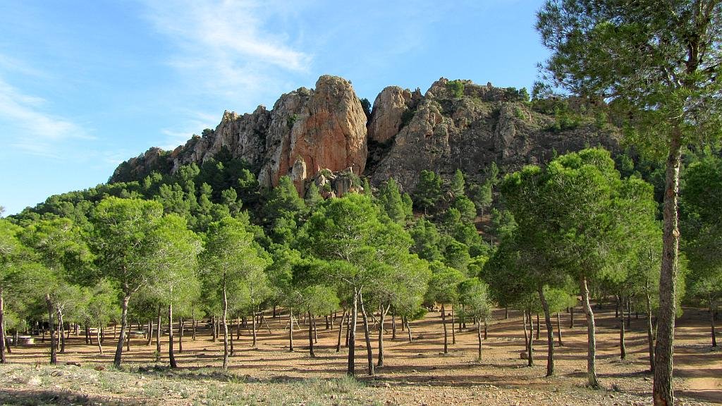
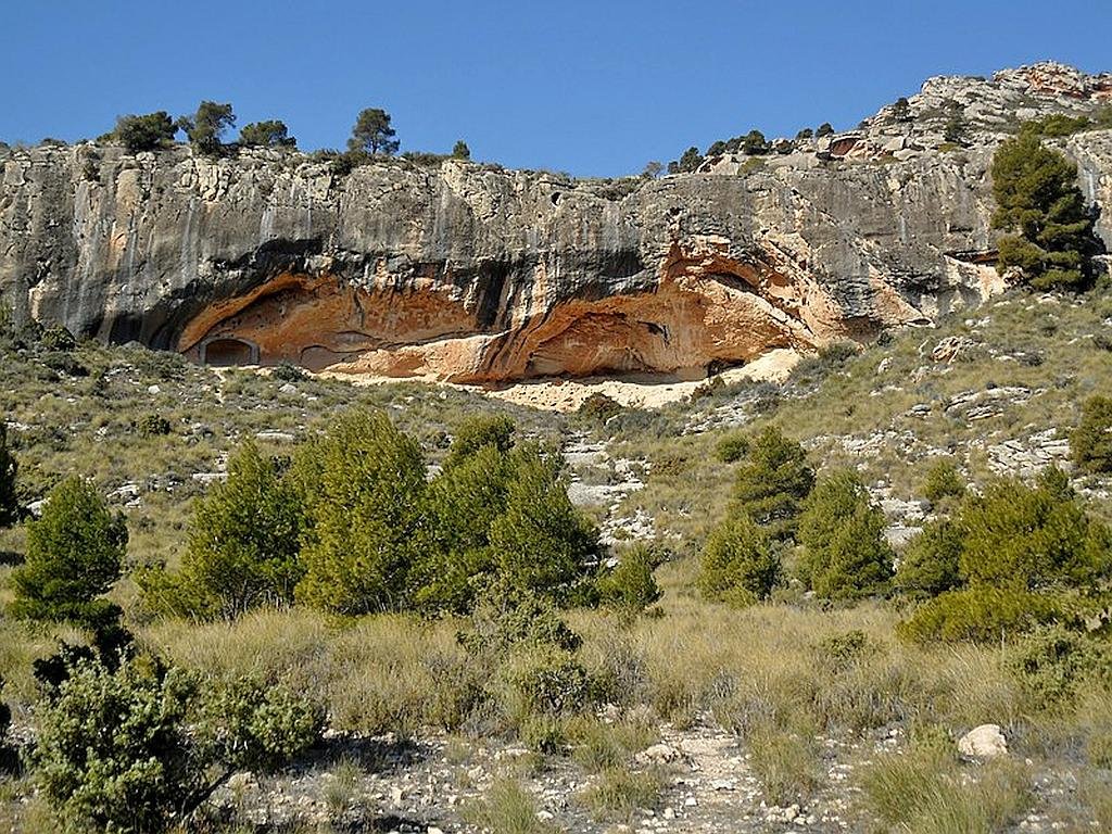
Monte Arabí (Located at the town of Yecla)

Mount Arabí is a mountainous area located in the municipality of Yecla in the province of Murcia. Its altitude is 1068 meters above sea level.

The most remarkable natural values ​​of the Arabí are the important and unique geomorphological formations forged by physical and chemical weathering. The result is a characteristic honeycomb pattern. In addition to a karst modeling, forming lapiaces, chasms and caves, such as the Cueva del Tesoro and the Cueva de la Horadada.

Read more

Protected landscapes (Paisajes protegidos) in Murcia

Protected landscapes (Paisajes protegidos) - Cuatro Calas

Protected landscapes (Paisajes protegidos) in Murcia are relatively small areas that for their ecological, habitat or other special reason such as the presence of specific types of wildlife are give some level of protection. Sometimes, but not always, they fall within the limits of a natural or regional park area. This is normally due to the expansion of the natural park territory. Very often they are located in areas where human actions has either damaged in the past or continues to damage the ecosystem creating a need for an environmental protection plan.

Read more

Carrascoy y El Valle Regional Park

Due to its proximity to Murcia, the Carrascoy y El Valle Regional Park (Parque Regional Carrascoy y El Valle) constitutes the main "green lung" of the capital
  • Region: Murcia
  • Declared a Natural Park: 1979. Regional Park 1992. Also listed as a Special Protection Area for Birds (ZEPA) and a Site of Community Importance (SCI).
  • Park surface area: 17,410 hectares
  • Towns and villages: Murcia, Fuente Álamo de Murcia, Alhama de Murcia, Sangonera la Verde, El Palmar, La Alberca, Beniaján, Corvera, Gea,Truyols and Sucina.

Points of interest

Due to its proximity to Murcia, the Carrascoy y El Valle Regional Park (Parque Regional Carrascoy y El Valle) constitutes the main “green lung” of the capital and its entire metropolitan area and It is made up of the extensive chain of mountains that close the valley of the Segura river and a part of the Guadalentín valley to the south.

Read more

Sierra Espuña Regional Park

The Sierra Espuña Regional Park is located at the eastern point of the Cordillera Betica and situated in the heart of Murcia
  • Region: Murcia
  • Declared a Natural Park: 1931 (Area of national Interest), 1978 (Natural Park), 1992 (Regional Park). Also listed as a Special Protection Area for Birds (ZEPA) and a Site of Community Importance (SCI).
  • Park surface area: 17,804 hectares
  • Towns and villages: Aledo, Alhama de Murcia, Librilla, Mula, Pliego and Totana

Points of interest

The Sierra Espuña Regional Park is located at the eastern point of the Cordillera Betica and situated in the heart of Murcia, one of Spain’s smallest provinces. It is a heavily wooded area in a generally arid zone.

  • At the end of the 19th century, the entire mountain range was in a lamentable ecological state, with the almost total loss of its tree mass and presenting serious desertification processes. In 1889, the forestry engineer Ricardo Codorníu undertook the enormous task of reforesting the entire mountain range. This reforestation project became a model for its time and was then carried out in many other areas across Spain.
  • The high peak called Pico Morrón, at 1,579m dominates the landscape which contains a combination of rock forms, each eroding at different rates. The limestone areas give the typical karst formations of deep valleys and caves.
  • There is a national hunting reserve and through this large mammals have been introduced, the European Mouflon (Ovis musimon) and Barbary sheep (Ammotragus lervia) are both at home in the dry, stony mountain peak areas.
  • The Sierra Espuña Regional Hunting Reserve has a surface area of ​​14,183 ha and a 76 km perimeter and is located within the Sierra Espuña Regional Park limits. Hunting in the reserve is dedicated to hunting larger game such as red deer and wild boar and is strictly monitered and managed.
  • In contrast to the pine clad mountains in the north-eastern area is the protected lunar type landscape made up of the mineral gypsum. The Barrancos de Gebas, known as the “bad lands” (tierras malas) are a succession of arid ravines and gullies.
Protected landscapes (Paisajes protegidos) - Barrancos de Gebas
Protected landscapes (Paisajes protegidos) – Barrancos de Gebas

Read more

Related Posts
  1. Coolest Places To Stay In London
  2. Unusual Day Trips From London
  3. Things To Do In London On A Budget
  4. London Expensive
  5. Hidden Places In London
  6. London City Trip Planner
  7. Best Shopping In London England
  8. Transport In London
  9. Best London Neighborhoods For Families
  10. First Trip To London